
Spatial Intelligence is rapidly evolving from an academic concept into a core driving force behind the fourth industrial revolution. This article provides a systematic and comprehensive interpretation of spatial intelligence. Starting from the core definition of spatial intelligence, it explains why it plays a crucial role in today's technological and social development. It breaks down in detail the complete process of building a spatial intelligence system and deeply analyzes its specific applications in fields such as autonomous driving, embodied intelligence, augmented reality (AR), and smart cities. It reviews the current mainstream technical frameworks and platforms, and offers an outlook on the challenges and future development trends in this field.
Imagine that the car you are riding in can navigate complex urban traffic as smoothly as an experienced veteran driver, not only recognizing traffic lights and vehicles, but also anticipating pedestrian movements and choosing the optimal route;
You put on a pair of lightweight AR glasses, and rich digital information is overlaid on the real-world buildings, streets, and shops before your eyes, as if the entire world had become an interactive interface;
City managers, through a huge digital screen, gain real-time insight into traffic flow, energy consumption, and public safety conditions, and make optimal resource scheduling decisions.
Behind these seemingly science-fiction scenarios, they all point to one common core technology—spatial intelligence. It endows machines with unprecedented capabilities: no longer merely "tools" that execute preset programs, but "partners" that can truly perceive, understand, and intelligently interact with the physical space we inhabit.

What Exactly Is Spatial Intelligence?—The Wisdom from Perception to Action
To understand spatial intelligence, we must first break a common misconception: it is far more than just GPS positioning. GPS can tell us "where we are," while what spatial intelligence seeks to solve is a series of deeper questions such as "what is here," "what is happening here," and "how should I act here."
Core Definition: Going Beyond "Knowing Where"
Spatial intelligence is an advanced artificial intelligence (AI) system whose core capability isdeep perception, understanding, reasoning, generation, and interaction with physical space based on three-dimensional vision and multimodal information . It emphasizes the machine's comprehensive processing capability for information such as spatial position, object shape, scene layout, relative relationships, and dynamic changes.
We can understand it with a simple analogy:
- Traditional positioning (such as GPS): It is like a messenger who only knows an address and coordinates. He can take you to a certain point, but he knows nothing about the environment around that point.
- Spatial intelligence: It is like an experienced local guide. He not only knows the address, but also understands what the buildings here are, which road gets congested during rush hour, where there is a newly opened café, and can even recommend the best touring route based on your preferences.
This "guide-style" intelligence is a key step for AI moving from the digital world into the physical world.
Key Capabilities: The Closed Loop of Perception, Understanding, Decision-Making, and Execution
The realization of spatial intelligence depends on a complete technological closed loop, which includes the following four core capabilities:
- Spatial Perception: It is the "five senses" of an intelligent system. It captures data from the physical world through various sensors. These sensors include:
- Visual sensors: Such as cameras, which capture two-dimensional information such as color and texture.
- Depth sensors: Such as LiDAR (Light Detection and Ranging) and ToF (Time of Flight) cameras, used to obtain precise three-dimensional spatial structure and distance information.
- Inertial measurement unit (IMU): Used to perceive its own posture and motion.
- Spatial Understanding & Reasoning: It is the "brain" of an intelligent system. It is responsible for interpreting the massive amount of perceived data, transforming it from raw pixels or point clouds into meaningful structured information. For example, it needs to recognize that this is a table and that is a pedestrian, and understand that the table is a "surface on which objects can be placed" and the pedestrian is a "moving object that needs to be avoided." This process relies heavily on computer vision, machine learning, and deep learning algorithms.
- Spatial Decision-Making: On the basis of understanding the environment, the system needs to decide "what to do next." For example, a self-driving car decides whether to accelerate, brake, or change lanes; a warehouse robot decides which package to grasp and plans the optimal grasping posture and movement path.
- Interaction & Execution: It is the "limbs" of an intelligent system. Decisions are transformed into actual actions in the physical world. This may be the precise operation of a robotic arm, or it may be the precise rendering by AR glasses of a virtual picture frame overlaid on a real wall.
These four links are closely connected, forming a continuously circulating and continuously optimizing intelligent closed loop, enabling machines to operate autonomously in complex dynamic environments.
Integration with Related Technologies: A Multidisciplinary Intersection
Spatial intelligence is not an isolated technology; it is the product of the integration of multiple cutting-edge technological fields. Its development cannot be separated from the support of the following key technologies:
- Artificial Intelligence (AI) and Machine Learning: Provide core algorithms and models for spatial understanding and decision-making.
- Computer Vision (CV): It is the key to realizing spatial perception, enabling machines to "understand" the world.
- Robotics: It provides the carrier for physical execution and is the embodiment of spatial intelligence's "action" capability.
- Geographic Information System (GIS): It provides powerful tools for processing and analyzing macro-scale geospatial data, and is the cornerstone of large-scale applications such as smart cities.
- Augmented Reality (AR) and Virtual Reality (VR): They are both application scenarios for spatial intelligence and also provide it with technical means for real-time three-dimensional reconstruction and virtual-real integration.
It is the interweaving and collision of these technologies that together gave rise to the powerful emerging field of spatial intelligence, giving it enormous potential to reshape our lives and work.
Why Is Spatial Intelligence So Important? — Reshaping the Interaction Between the Physical World and the Digital World
The importance of spatial intelligence lies in the fact that it is fundamentally changing the way humans and machines, and the digital world and the physical world, interact. It is not merely an improvement in efficiency, but a profound paradigm shift.
Empowering Autonomous Systems and Liberating Human Productivity
Spatial intelligence is the key to achieving true "autonomy." Whether it is drones flying in the sky, self-driving cars driving on the ground, or robots in factories, all require spatial intelligence to give them the ability to work independently in complex environments.
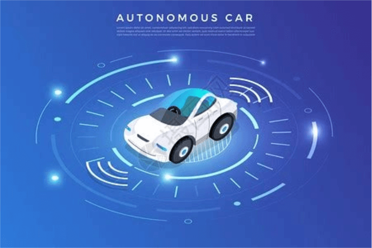
- In the transportation field: Autonomous vehicles use spatial intelligence technology to build real-time 3D maps of the surrounding environment through sensors such as LiDAR and cameras, accurately identifying vehicles, pedestrians, road signs, etc., and making driving decisions. This is expected to completely transform our way of traveling and greatly improve traffic safety and efficiency.
- In the industrial and logistics fields: Intelligent warehousing robots can navigate autonomously, precisely locate shelves in warehouses of tens of thousands of square meters, and use robotic arms to grab and place packages. In smart factories, robots can work collaboratively with humans on production lines to perform high-precision assembly tasks. This greatly improves production efficiency and reduces labor costs.
Creating immersive experiences, connecting the virtual and the real
Spatial intelligence is the cornerstone of realizing AR, VR, and Metaverse experiences. Without a precise understanding of real physical space, virtual information cannot be perfectly integrated with the real world.
- Augmented reality (AR): When you use AR navigation, the application needs to use spatial intelligence to identify the roads and buildings in front of you so that it can accurately project virtual navigation arrows onto the ground. Similarly, AR games (such as Pokémon GO) also need to understand terrain and spatial layout so that virtual characters appear to truly exist in the environment.
- Virtual reality (VR) and digital twins: Spatial intelligence technology can perform high-precision three-dimensional reconstruction of real scenes (such as a factory or a city), creating so-called "Digital Twins." In this virtual digital copy, we can conduct simulations, deductions, and optimizations, and then apply the optimal solution to the physical world, greatly reducing the cost of trial and error.
Optimizing resource allocation, building smarter cities and lives
At the macro scale, spatial intelligence, especially geospatial intelligence (GeoAI) formed by combining it with geographic information systems, is becoming the "super brain" of urban management and social governance.
- Smart city management: By analyzing multi-source spatial data such as satellite imagery, drone aerial photography, and ground sensors, city managers can achieve intelligent scheduling of traffic flow, dynamic monitoring of urban land use, and rapid early warning and emergency response for disasters (such as floods and fires).
- Precision agriculture: By analyzing remote sensing imagery of farmland and soil sensor data, spatial intelligence can assess crop growth, predict pests and diseases, and guide drones in precise fertilization and pesticide spraying, thereby increasing yields while reducing resource waste.
- Environmental protection: Scientists use spatial intelligence to analyze global satellite data and monitor environmental issues such as deforestation, glacier melting, and ocean pollution, providing a scientific basis for formulating effective protection policies.
The importance of spatial intelligence is reflected in how it acts like a bridge, extending AI's powerful computing and analytical capabilities from the virtual digital world to the physical world we depend on for survival, releasing unprecedented value in every aspect of production, life, and governance.
How to build a spatial intelligence system? — A full-process analysis from data to deployment
Building a spatial intelligence system is a complex systems engineering project involving the deep integration of data, algorithms, hardware, and application scenarios. According to industry best practices, the construction process can be roughly divided into four core stages, which can be compared to the process of "training a robot guide."
Stage one: Data collection and preprocessing — "Let the guide open its eyes and see the world"
It is the starting point of all intelligent systems; the quality and breadth of data directly determine the upper limit of system capabilities.
- Data Acquisition: First, the system needs to be equipped with "eyes" and "ears." This includes collecting raw data from various sources, such as:
- Sensor Data: Camera images, LiDAR point clouds, GPS trajectories, Internet of Things (IoT) device readings, etc.
- Geospatial Data: Satellite imagery, high-precision maps, administrative division maps, building models, etc.
- User-Generated Content: Such as geotagged social media photos and posts.
- Data Preprocessing: The collected raw data is "raw meat" that needs to be "cooked" before it can be "digested" by the model. This process includes:
- Data Cleaning: Removing noise, filling in missing values, correcting erroneous data.
- Data Fusion: Aligning data from different sensors (such as images and point clouds) in time and space.
- Data Annotation: This is the most time-consuming but crucial step. Manually or semi-automatically labeling the data, for example, marking "cars," "pedestrians," "traffic lights," etc. in images, to tell the model what it should learn.
Phase Two: Model Training and Validation—"Teaching the Guide to Recognize and Understand the World"
It is the core step that transforms data into intelligence, equivalent to teaching our "robot guide" how to think.
- Model Selection: Choosing an appropriate AI algorithm model based on the specific task. For example, image recognition may use Convolutional Neural Networks (CNN), and 3D point cloud segmentation may use more specialized models such as PointNet.
- Model Training: "Feeding" the preprocessed massive annotated data to the model. Through repeated learning, the model continuously adjusts its internal parameters until it can accurately identify target patterns from input data (for example, recognizing a car in a new image it has never seen before).
- Model Evaluation & Validation: Using "exam data" that never appeared during training to test the model's performance, evaluating metrics such as accuracy and recall, ensuring that it has not "rote memorized" but truly mastered generalization ability. This process is repeated until the model's performance meets the requirements.
Phase Three: Spatial Analysis and Decision Support—"Letting the Guide Learn to Think and Plan"
The trained model has acquired comprehension ability; next, it must use this ability to solve real-world problems.
- Spatial Analysis: Applying the model to new, real data for pattern recognition, relationship mining, and trend prediction. For example, analyzing urban traffic camera data to identify congestion patterns and predict traffic conditions in the next half hour.
- Decision-Making: Based on the analysis results, the system generates decision recommendations for human reference, or directly drives autonomous systems to operate. For example, sending suggestions to the traffic management center for adjusting traffic light durations.
- Visualization: Present complex analysis results in an intuitive way, such as interactive maps, 3D scenes, data dashboards, etc., to help human users quickly understand the situation and make final judgments.
Phase 4: System Deployment and Monitoring — "Putting the guide to work and enabling continuous learning"
The final step is to integrate the entire intelligent system into the actual application environment so that it truly begins to create value.
- Model Deployment: Package and deploy the trained model onto the target hardware, for example embedding it into a vehicle's computing unit, or deploying it on a cloud server to provide services through an API.
- Integration and Application: Combine the model with other software modules such as business logic and the user interface to form a complete product or solution.
- Monitoring & Iteration: After the system goes live, it is necessary to continuously monitor its performance in the real world. Because the real world always presents unexpected new situations (for example, a new model of vehicle), the model may make mistakes. By collecting these "wrong answers," the model can be retrained and optimized, allowing it to continuously evolve and become increasingly intelligent.
Only by following this process and adhering to best practices such as interdisciplinary collaboration and attention to data quality can a stable, reliable, and efficient spatial intelligence system be successfully built.
How Do We Use Spatial Intelligence? — Typical Application Scenarios
The applications of spatial intelligence have already permeated every aspect of our production and life. Let us take a deep dive into several of the most representative application scenarios.
Autonomous Driving: The Car's "Eyes" and "Brain"
Autonomous driving is one of the most extreme and complex applications of spatial intelligence. An L4/L5 autonomous vehicle is a highly integrated mobile spatial agent. Through cameras, millimeter-wave radar, and lidar around the vehicle body, it builds a 360-degree, centimeter-level accurate 3D world model in real time. In this model, it can not only recognize other vehicles, pedestrians, and bicycles, but also understand traffic rules (stop on red, go on green), road structure (lane lines, curbs), and potential risks (a child suddenly darting out). Its "brain" (a high-performance computing platform) makes dozens of decisions per second based on this spatial understanding, controlling the vehicle's steering, acceleration, and braking to ensure driving safety and smoothness.
Embodied Intelligence and Robots: Enabling Robots to "Move Freely" in the Physical World
Embodied AI is currently a hot topic in the AI field. Its goal is to create agents that can move, perceive, and operate freely in physical environments like humans, and spatial intelligence is its core. Whether it is Boston Dynamics' bipedal robot Atlas or the sorting robots in Amazon warehouses, they all need:
- Real-Time Localization and Mapping (SLAM): In an unfamiliar environment, explore while mapping, and determine one's own position on the map.
- Dynamic Obstacle Avoidance and Path Planning: Identify static obstacles (such as walls and shelves) and dynamic obstacles (such as people walking around) in the environment, and plan a safe and efficient path.
- Object Recognition and Manipulation: Recognize a target object (such as a specific product), analyze its shape, pose, and position, and then plan the motion trajectory of the robotic arm to complete precise grasping, placement, or assembly.

AR/VR and the Metaverse: Building a Digital Twin World
Spatial intelligence is the "adhesive" connecting reality and the virtual. In AR applications, the camera of a phone or AR glasses needs to scan the surrounding environment in real time, understanding the position and dimensions of planes such as walls, floors, and tables, so that virtual objects (such as a virtual sofa) can be "anchored" in real space, appearing as if they truly exist, and when you walk around, it will stay in place. In the grander vision of the metaverse, spatial intelligence technology is used to create high-fidelity 3D modeling of an entire city or even the Earth, building a "digital twin" world that is synchronized in real time with the physical world and interactive, providing an unprecedented platform for socializing, entertainment, work, and scientific research.
Geographic Information Science (GeoAI): Gaining Insight into the Earth from a Macro Perspective
GeoAI (Geospatial Artificial Intelligence) is the application of spatial intelligence at the macro geographic scale, combining the powerful analytical capabilities of AI with the spatial data processing capabilities of GIS. Application cases include:
- Urban planning: By analyzing spatial data such as population density, traffic patterns, and distribution of public facilities, it assists in planning the locations of new residential areas, schools, and subway lines.
- Disaster monitoring: Using AI to analyze satellite remote sensing images, it can automatically identify and delineate the extent of forest fires, or assess the degree of damage to houses after an earthquake, providing first-hand information for rescue decisions.
- Business site selection: Retail companies can use GeoAI to analyze the demographic profile, consumption level, competitor distribution, and transportation convenience of a certain area, thereby scientifically deciding where a new store should be opened.
Smart cities and smart homes: Ubiquitous environmental intelligence
From magnificent cities to cozy homes, spatial intelligence is making our environments "understand you better."
- Smart cities: The city's traffic system analyzes video streams from cameras across the city, intelligently adjusts traffic light timing, and alleviates traffic congestion.
- Smart homes: The smart speaker or control center at home can know which room you are in and, based on your location and activity status, automatically adjust the lighting, temperature, and music in that room. Future smart home systems may even understand more complex spatial contexts, such as automatically opening the refrigerator door for you when you place a shopping bag on the kitchen counter.
Core Technical Frameworks and Platforms
The vigorous development of spatial intelligence is inseparable from the support of powerful open-source frameworks and commercial platforms behind it. These tools have greatly lowered the threshold for developers to get started and accelerated the application and innovation of technology.
Basic AI frameworks: The cornerstone of building intelligence
Almost all spatial intelligence applications are built on general deep learning frameworks. These frameworks provide underlying algorithm libraries, computational graph optimization, and hardware acceleration capabilities.
- TensorFlow & PyTorch: As the two most mainstream deep learning frameworks today, they provide developers with flexible tools for building and training complex neural network models, and are the de facto standards for research and implementation of spatial intelligence algorithms.
- OpenCV: It is a powerful open-source computer vision library that provides a large number of ready-made algorithms for tasks such as image processing, feature extraction, and object detection, and is an important toolkit for realizing spatial "perception" capabilities.
Specialized libraries for spatial data processing: The "Swiss Army knife" of geographic information
For the special type of geospatial data, the community has also developed a series of professional processing tools.
- GeoPandas: This Python library combines the powerful data analysis capabilities of Pandas with the geospatial object processing capabilities of Shapely, allowing developers to easily read, write, process, and analyze geospatial vector data such as points, lines, and polygons.
- New-generation full-space intelligent GIS platforms: Many modern GIS platforms have begun to deeply integrate AI capabilities. They not only incorporate open-source map libraries and visualization libraries, but also include built-in high-performance spatial analysis algorithms and 3D analysis functions, supporting intelligent mining of massive spatiotemporal data.
IoT and Smart Space Platforms: The "Nerve Center" Connecting Everything
These platforms focus on building "smart spaces" that can perceive and control the physical environment, and are the core of scenarios such as smart homes and smart buildings.
- Open-source frameworks:
- dSpace / Smart-M3: This type of open-source framework aims to provide a standardized methodology and software infrastructure for "smart spaces," allowing developers to conveniently model and interact with spaces, sensors, and devices.
- TuyaOpen (Tuya Smart): An open-source development framework launched by IoT giants such as Tuya, integrating capabilities such as device connectivity, voice interaction, and large model invocation, helping developers quickly build cross-brand, cross-category whole-home smart scenarios.
- Commercial platforms:
- Baidu AI Cloud, Manycore Tech, and others: Technology giants at home and abroad have successively launched their own spatial intelligence platforms. For example, Baidu AI Cloud provides a one-stop toolchain from model development to application deployment, while Manycore Tech, which focuses on 3D content generation, has launched SpatialLM, the first open-source multimodal spatial understanding large model, aiming to enhance AI's ability to understand physical space.
The Layout of Commercial Giants: Explorations by Google, OpenAI, and Other Companies
Top technology companies are promoting the development of spatial intelligence from a more fundamental level.
- Google: It has deep accumulated experience in the field of GeoAI, and its Google Earth Engine platform provides massive global satellite imagery data and cloud-based analysis capabilities. At the same time, Google Research also continues to invest in fields such as AR, robotics, and autonomous driving, exploring more advanced spatial perception and interaction technologies.
- OpenAI: Although it is known for language models, its latest multimodal large models (such as the GPT-4 series) have initially acquired the ability to understand image content and spatial relationships. In the future, large models that more closely integrate language, vision, and action capabilities will be a key direction for achieving more advanced spatial intelligence.
Challenges and Future Outlook
Although spatial intelligence has broad prospects, its development and popularization still face a series of technical, cost, and ethical challenges.
Current Technical and Ethical Challenges
- High costs and technical barriers: High-precision sensors (especially LiDAR) are expensive, the collection and annotation of massive data are costly, and complex model training requires strong computing power support, all of which limit the popularization of the technology.
- Data fragmentation and privacy issues: Spatial data comes from diverse sources with inconsistent standards, making integration difficult. At the same time, ubiquitous cameras and sensors have also aroused deep public concern about personal privacy and data security.
- Algorithm robustness and long-tail problems: Systems such as autonomous driving need to maintain absolute reliability in endless "long-tail scenarios" (Corner Cases, that is, rare but possible extreme situations), which places extremely high demands on algorithm robustness.
- The lag in ethics and regulations: How should self-driving cars make decisions when faced with the "trolley problem"? Where is the boundary for the use of intelligent surveillance? The relevant laws, regulations, and ethical norms have not yet kept pace with the pace of technological development.
Future development trend: moving toward spatio-temporal integrated embodied intelligence
Spatial intelligence will develop in a direction of greater integration, greater autonomy, and greater inclusiveness.
- Spatio-temporal Intelligence: Future intelligent systems will not only understand "space" but will also understand "time" more deeply. They will be able to analyze the temporal changes of things, predict their future development trajectories, and achieve a leap from static understanding to dynamic prediction.
- Deep integration with embodied intelligence: Spatial intelligence will no longer merely "see" and "think," but will be more closely combined with physical entities (robots), becoming a true "embodied intelligent agent" capable of completing complex tasks in the physical world. This will greatly expand the application boundaries of AI, extending from information processing to physical operations.
- Driven by multimodal large models: Multimodal large models like GPT-4 that can simultaneously process text, images, video, and even 3D signals will become the "new foundation" of spatial intelligence. Their powerful common-sense reasoning and generalization capabilities are expected to solve many "long-tail problems" that depend on specific small models, making intelligent systems more general and powerful.
- Democratization and popularization of technology: As sensor costs decrease, open-source tools become abundant, and cloud computing becomes widespread, the threshold for building spatial intelligence applications will continue to lower. In the future, small and medium-sized enterprises and even individual developers will be able to use these tools to create imaginative spatial intelligence applications, promoting the prosperity of the entire ecosystem.
Spatial intelligence, as a core technology that gives machines the ability to understand and interact with the physical world, is leading a profound social and technological transformation. It is no longer a distant future fantasy, but a reality that has already happened around us. From every precise decision made by self-driving cars on the road, to every piece of virtual information overlaid in front of our eyes by AR glasses, to every efficient allocation of resources by the smart city brain, spatial intelligence is reshaping our world in its own unique way.
As technology continues to mature and application scenarios continue to expand, spatial intelligence will become a solid bridge connecting the digital world and the physical world. It will create unprecedented economic value, solve urgent social problems, and ultimately lead us into a more intelligent, efficient, safe, and convenient future. For each of us, understanding spatial intelligence means understanding the next era we are about to enter.
Summary of key points
Spatial intelligence is an advanced AI system beyond simple positioning, capable of perceiving, understanding, reasoning about, and interacting with physical space
It forms a closed-loop system composed of four core capabilities: perception, understanding, decision-making, and execution
Spatial intelligence is reshaping multiple fields such as transportation, industry, urban management, and daily life
Building a spatial intelligence system requires four stages: data collection, model training, spatial analysis, and system deployment
Future development directions include more efficient data processing, more accurate environmental understanding, more intelligent decision support, and more natural human-computer interaction