
What is ABot-Earth 0.5
ABot-Earth 0.5 is the world's first 3D-native city world model launched by Amap under Alibaba Group, positioned as an automated 3D city factory. Users input a single satellite image or text description, and the system can generate a kilometer-scale high-precision 3D city scene in 10 minutes on a consumer-grade GPU, outputting editable 3DGS format assets that can be directly imported into mainstream engines such as Unity and UnrealEngine.
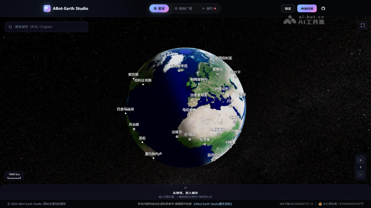
Main features of ABot-Earth 0.5
-
Single-image/text generation of 3D cities: Input a single satellite image or a text description, and the system automatically generates a kilometer-scale high-precision 3D city scene, enabling direct conversion from 2D information to 3D assets.
-
Minute-level efficient reconstruction: It takes only about 10 minutes on a consumer-grade GPU to complete city-scale scene generation, compressing the manual modeling process that traditionally takes days or even weeks into minutes.
-
3DGS format output: The model outputs editable 3D Gaussian Splatting format assets, retaining the scene's geometry, texture, and semantic information, and supporting secondary development.
-
Seamless engine integration: The generated 3D assets can be directly imported into mainstream game engines and visualization platforms such as Unity and UnrealEngine.
-
Global coverage: 3D map data covering more than 190 countries and regions has been built, supporting 3D city generation for any terrain worldwide.
Technical principles of ABot-Earth 0.5
-
3D Gaussian Splatting (3DGS) representation: It uses 3D Gaussian splatting technology as the core scene representation method, fitting city geometry and appearance with millions of 3D Gaussian ellipsoids with color, transparency, and covariance parameters. Compared with traditional meshes or NeRF, it offers the advantages of being editable, capable of real-time rendering, and easy to import into engines.
-
End-to-end reconstruction with generative AI: Based on generative models trained on large-scale urban satellite imagery and geographic data, it infers 3D structure, building height, surface texture, and semantic labels from a single 2D image or text semantics, completing end-to-end mapping from input to 3DGS parameters through deep learning.
-
Automated 3D factory pipeline: It builds a fully automated data processing and generation pipeline, replacing the traditional asset-heavy process that relies on photogrammetry, manual model repair, and material texturing, enabling unattended production from input to editable 3D assets.
-
Lightweight inference and thousand-fold acceleration: Through model compression, inference optimization, and parallel computing acceleration for consumer-grade GPUs, the computational threshold for city-scale 3D reconstruction is lowered from professional render farms to a single consumer-grade graphics card, achieving breakthroughs of about 1,000 times efficiency improvement and cost reduced to 1% of traditional methods.
How to use ABot-Earth 0.5
- Apply for beta testing: Visit the model's official website https://abot-earth.amap.com/,点击右上角「申请内测」按钮,填写相关信息提交测试资格审核。
- Create a project: After approval, log in to ABot-Earth Studio, enter the console to create a new scene, and choose the "Image Generation" or "Text Generation" mode.
- Input data Upload a satellite image, or enter a text description of the target city in the text box, and the system automatically parses geographic and architectural semantic information.
- Wait for generation After submission, the model runs in the cloud, and in about 10 minutes it can complete the automatic reconstruction and rendering of a kilometer-scale 3D city scene.
- Download assets After generation is complete, download the standard 3DGS format files to obtain an editable 3D city asset package.
Core Advantages of ABot-Earth 0.5
-
Cost disruption: The cost of 3D city mapping is only 1% of traditional manual modeling methods, transforming high-precision 3D generation from a "heavy asset" into a "lightweight tool".
-
A thousand times more efficient: A kilometer-scale scene can be generated in 10 minutes on a single consumer-grade GPU, improving overall efficiency by about 1,000 times compared with traditional workflows.
-
Extremely low barrier to entry: No professional render farm or workstation is required; an ordinary consumer-grade graphics card is sufficient, greatly reducing hardware investment.
-
Universal format: Natively outputs the standard 3DGS format, which can be directly imported into mainstream engines such as Unity and UnrealEngine for plug-and-play use.
-
Global coverage: A 3D map covering more than 190 countries and regions has been built, making it the 3D city dataset with the widest global coverage at present.
Project Address of ABot-Earth 0.5
- Project official website:https://abot-earth.amap.com/
- Technical report:https://github.com/amap-cvlab/ABot-Earth-0.5/blob/main/tech-report.pdf
Comparison of ABot-Earth0.5 with Similar Competing Products
| Dimension | ABot-Earth 0.5 | Google Earth Studio | CityEngine |
|---|---|---|---|
| Generation method | AI single-image/text direct generation | Browsing based on existing satellite data | Rule-driven modeling |
| Generation speed | 10 minutes | Real-time browsing (not generation) | Several hours to several days |
| Hardware requirements | Consumer-grade GPU | Browser is sufficient | Professional workstation |
| Output format | 3DGS (editable) | Not editable | Proprietary format |
| Coverage | 190+ countries | Global | Requires manual construction |
| Cost | 1% of traditional | Free browsing/paid API | High licensing fees |
Application Scenarios of ABot-Earth 0.5
-
Game development: Rapidly generate open-world 3D city base maps, greatly reducing the cost of producing art assets.
-
Embodied intelligence: Provide high-precision 3D city training data and simulation environments for robots and autonomous driving.
-
Low-altitude economy: Support the construction of 3D digital base maps for drone route planning and airspace management.
-
Emergency rescue: Reconstruct the 3D environment of disaster sites at the minute level, providing a scientific basis for command and dispatch.
-
Film and television production: Rapidly generate digital twin city backgrounds for virtual shooting and previews.